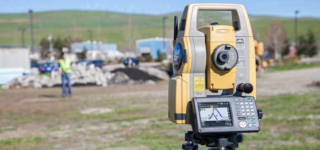
Topcon Positioning Systems has introduced the DS-200 with superior tracking technology to the Australian market. The DS-200 system sets a new standard for entry-level robotic total stations, providing accuracy, durability, reliability and compatibility with Topcon GNSS hardware. Aptella Survey Products Manager Cameron Waters describes the DS-200 as a “feature-rich product, boasting high-end capability without the high-end price tag”. The Topcon DS-200 is the ideal tool across a range of surveying disciplines, including cadastral, engineering and construction work. It also uses the same batteries as the Topcon HiPer GPS series, making them a perfect partner. The DS-200can be used safely in environments of high dust and water, allowing for greater productivity in the field. It comes with the world’s
Craig Miller, a Director at Perth-based Vision Surveyors, outlines the increase in productivity and efficiency the company has achieved thanks to the latest in survey technology. Established in 2004, Vision Surveys specialises in land development and strata titles, employing four survey crews. In recent years, the company has invested in the latest technology from Topcon and is seeing dramatic improvements in time saving and in-field efficiency as a result. “We’ve undergone major upgrades to our survey equipment twice in the last four years,” Mr Miller explains. “In 2010, we got talking with the team at Aptella and they were able to demonstrate some of the latest Topcon technology for us, which was a huge improvement on our setup

Combining Ground Penetrating Radar (GPR), laser scanning and Unmanned Aerial System (UAS) technology to deliver underground, structural and aerial imagery for accurate asset and property management. Maintenance of a building over its lifetime is reported to cost more than the building’s original construction. Knowing where underground services and building assets accurately sit is a challenge that can add time and cost to any work carried out. Old plans, many of which are original paper designs or mud-maps can often prove unreliable as more often than not, assets are repositioned during the build. Reliable facilities management data that includes accurate location information can help facilities managers better plan their maintenance actions and reduce costs. The older the structure, the