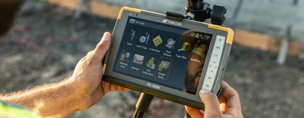
Topcon Positioning Group announces the latest addition to its line of field controllers for surveying and construction professionals — the FC-5000. With a 7-inch, sunlight-readable display and rugged hardware, the FC-5000 is designed to offer users a large, versatile and fast handheld computer for all on-site and field applications. “At 7-inches, the FC-5000 has the largest handheld data controller screen in our product line,” said Ray Kerwin, Topcon’s Director of global surveying products. “The display has a capacitive touch interface — with finger, glove, small tip stylus and water capable options — that is optically bonded to increase visibility. With the press of a key, a user can change the orientation of the screen from portrait to landscape
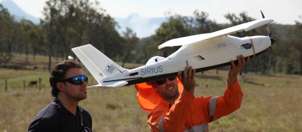
BHP Billiton has successfully deployed Remotely Piloted Aircraft System (RPAS) technology, commonly referred to as ‘drones’ or ‘Unmanned Aircraft Systems (UAS). In a recent article in The Weekend Australian, project leader Jason Wadsworth explains how the use of RPAS gives engineers and operators “better visibility about what is going on” across the mine site. Mr Wadsworth highlights the safety and productivity benefits of the technology, as RPAS reduces the need for surveyors to enter the pit. The data captured with the system can also be used to check safety compliance and verify the site is working within its specifications. Interestingly, Mr Wadsworth suggests that the use of RPAS is giving mine surveyors more cudos on site, lifting their profile to that of
Matthew Smith is a Director of CEH (Dapto) Pty Ltd, an Illawarra and Sydney-based firm of land and mine surveyors. An aerobatics pilot in his spare time, with several state and national championship titles to his name, Mr Smith and colleague Robert Dickers, a former long-haul freight pilot, have embraced a new way to fly with the introduction of the company’s first Remotely Piloted Aircraft System (RPAS). CEH Survey hopes that RPAS will replace traditional survey methods for large scale surveys and stock pile volumes. “I think there will always be a place for total stations and GNSS, however for some applications RPAS enables us to capture comprehensive data considerably faster and more safely,” Mr Smith said. The