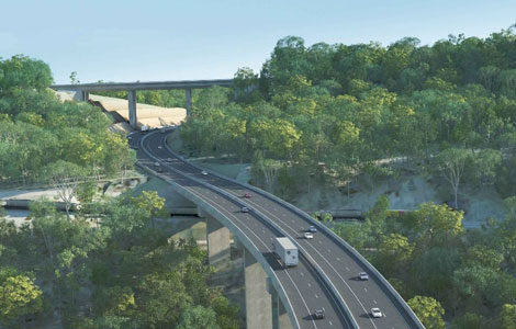
CLIENT: Aptella, NEXUS DELIVERY (Ferrovial Agroman – Acciona) THE CHALLENGE The Toowoomba Second Range Crossing is the largest Australian Government funding commitment to a single road project in Queensland’s history ($1.6 billion – 43km). One of the main engineering features of the project is “the viaduct”, an 800m long bridge that will negotiate the steep terrain of the range. The Senceive system was used to monitor the Brisbane-Toowoomba Railway and its surroundings during early earthwork, piling and blasting activity. This involved the rapid relocation of the monitoring system in different areas of the valley as works progressed. OUR SOLUTION The initial monitoring area was located directly under the bridge path. 42 wireless tilt nodes were positioned on the
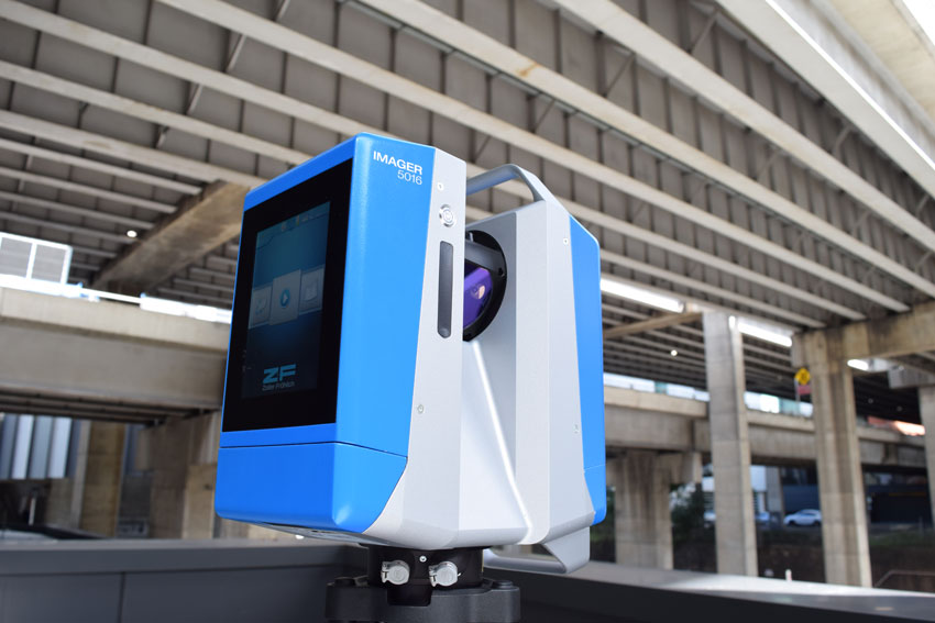
Z+F’s 5016 model is a smaller, faster and lighter 3D laser scanner than its predecessors, with the same reliability and accuracy the company’s instruments are renowned for. With an extended 360-metre range and 360 x 320 degree field of view, the new 5016 enables precision scanning of larger areas, whilst reducing the number of scan positions required to a minimum. In-field registration Capturing more than one million points per second, the 5016 offers the same high quality scans and the unique in-field registration capability first introduced with the 5010X model. This ‘Blue Workflow’ involves an optimised surveying and data processing solution that enables users to register, check, edit and evaluate point cloud data in the field, whilst scanning.
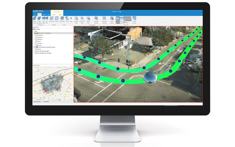
Topcon Positioning Group announces its MAGNET® system of software solutions has expanded to offer a package designed to consolidate and facilitate the working environment for point cloud data processing and visualisation — MAGNET Collage. The system offers an “all-in-one” solution for professionals using laser scanners, mobile mapping devices, modern paving scanners, and traditional surveying instruments. “With MAGNET Collage, mass data users with multiple sensors, such as mobile and static instruments, can stay in one software environment to process point cloud data and imagery,” said Jason Hallett, vice president of Topcon global product management. “Traditionally, each mass data sensor would require standalone software. Now with Collage, processing can be completed more quickly by combining all the raw scanning data
Ben Ritchie is a surveyor with a difference: having taken a 10-year hiatus from working with the land to work in the sky as a commercial pilot, he recently returned to the surveying industry with a view to combining his skills and leading the way for Veris’ aerial mapping services. Veris, known until November last year as OTOC, was formed from eight businesses joined by a vision to create a world-class planning, design, surveying and spatial solutions business that could service clients across Australia. Lester Franks is a 35-strong team based in Devonport, Tasmania, that specialises in delivering clients comprehensive surveying services that incorporate the latest technology. “3D laser scanners, sonar and more recently drones complement traditional survey