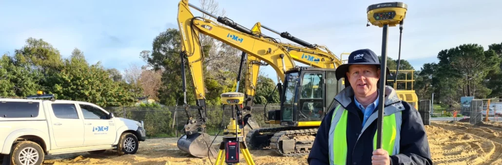
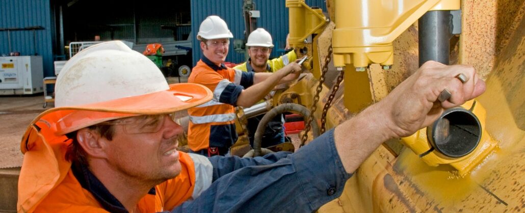
DM Civil is a mid-sized civil construction company in Western Australia that has a reputation for being early adopters of technology. Mark McGurdy, Survey Manager at DM Civil makes sure he’s abreast of any new developments hitting the market and this made him a natural fit to test MiRTK. “Karl O’Toole from Aptella approached me and asked if we’d be interested in testing MiRTK, to evaluate it and report on how it went. We gave it a go and we’ve been testing it now for a few months and like I say: Where you need it, it’s perfect! It works every time,” said Mr McGurdy. MiRTK – Correction Service integrates seamlessly with existing GNSS on site Mr McGurdy
a replacement for UHF radios that is easy to use, works with all makes and models of GPS equipment and is available to buy online for a 12-month or 24-month subscription. Access the on-demand webinar MiRTK is the new way to receive correction data from your base station and its available for sale today from Aptella! Say goodbye to the frustrations of working with UHF radios once and for all with this refreshingly simple and reliable subscription service. Please register for MiRTK | Internet enabled correction service for your base station on Aug 27, 2020 4:29 PM AWST Access Webinar
Whilst all machine control laser receivers are all capable of receiving a laser beam, which by its very nature is millimetre accurate in most cases, this does not mean the system is “mm-GPS”. Topcon mm-GPS, the only true mm-GPS, is heavily patented and was released by Topcon in 2005. It uses fan-beam laser technology only available to Topcon to pair the mm-accurate vertical positioning of the Topcon mm-GPS laser transmitter (the PZL-1 or the LZ-T5) with GNSS positioning to create truly mm-accurate 3D machine control positioning. Other systems and other brands may claim they can do “millimetre”, but that simply means they are using an off the shelf standard flat plane or sloping laser transmitter and a simple
At Aptella, we focus on customer support and ensuring that the Fleet Management System (FMS) and high precision machine guidance platforms are truly embedded within the operational workflow of your mine. Investing in technology is a key milestone to improving productivity and optimising production in mining. To truly gain valuable insights and make the solution work for your mine site, you need to have peace of mind that your supplier will be there to provide technical support, customisation and training to your staff. The best Fleet Management System isn’t necessarily the most complex In choosing the right FMS solution for your mine site, it is all too easy to be wowed by features and think that the more
New Berrimah office provides laser level calibrations, repairs, sales, rental and training services across the range of Topcon surveying and machine control solutions. Intelligent positioning solutions provider Aptella has a new office for the company’s Darwin team. The new Berrimah premises offers a full range of services to support customers in the construction, geospatial and mining sectors with laser levels, GPS, survey instruments and machine control technology. “We look forward to welcoming customers at our new premises at 29 Miles Road, Berrimah, and helping them with their technology needs or equipment services,” said Bradd Thexton, Field and Support Manager for the Northern Territory at Aptella. “If your laser level is due for a calibration, drop into the new
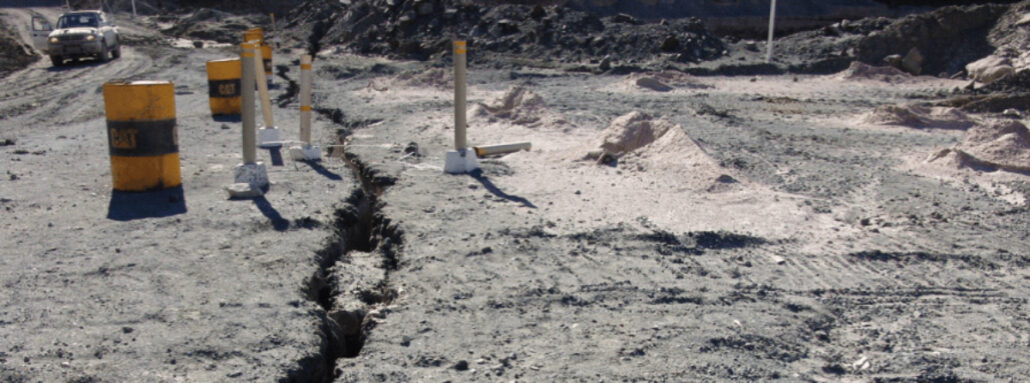
In a large Australian coal mine, a significant crack developed in one of the main walls of the pit. Finding a robust platform that could reliably measure any deviation in the wall and alert management immediately was critical to mitigate safety and production risk. Traditional optical monitoring techniques utilising a total station could be used in these scenarios. Although accurate, the manual operation of such an instrument would not generate the frequency of data required and increase the level of risk by requiring its manual operation. An autonomous optical solution would mitigate this but with a greater footprint of infrastructure and cost. Wireless, autonomous monitoring In this scenario, the Senceive wireless monitoring solution was established on site to