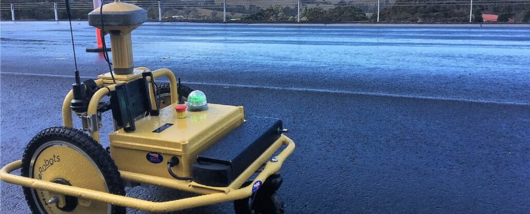
The Shire of Esperance is constantly on the look out for new technology and solutions that can make life easier for the surveyors working on the creation of new roads and maintenance of existing roads within the Shire of Esperance. The Shire of Esperance is constantly on the look out for new technology and solutions that can make life easier for the surveyors working on the creation of new roads and maintenance of existing roads within the Shire of Esperance. This led Paul Farmilo, Technical Officer – Fleet to the Tiny Surveyor line marking machine from Aptella, which he saw as the ideal instrument to increase the efficiency and reduce the mundane tasks for the surveyors working on
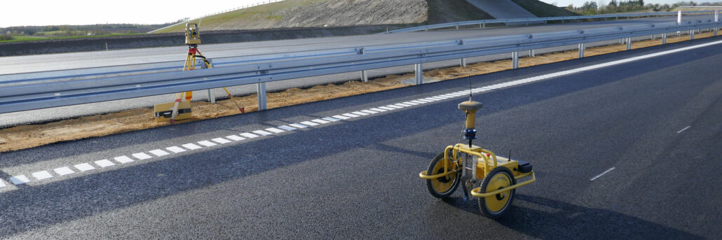
Dayne Corps, Director, Karratha Earthmoving saw a video on YouTube of the Tiny Surveyor GPS Line Marker robot from Aptella in action and thought it would be the ideal instrument to implement into his technology arsenal. Mr Corps initially purchased the Tiny Surveyor intending to use it for line marking but knew his team of surveyors would embrace it and build on their use of the instrument to continually make their workflow more efficient. “We’re a company that is looking forward to keep ahead with technology, so when I got the Tiny Surveyor GPS Line Marker I knew that we could use it but I also knew that we’d grow with our use of it because we’re that
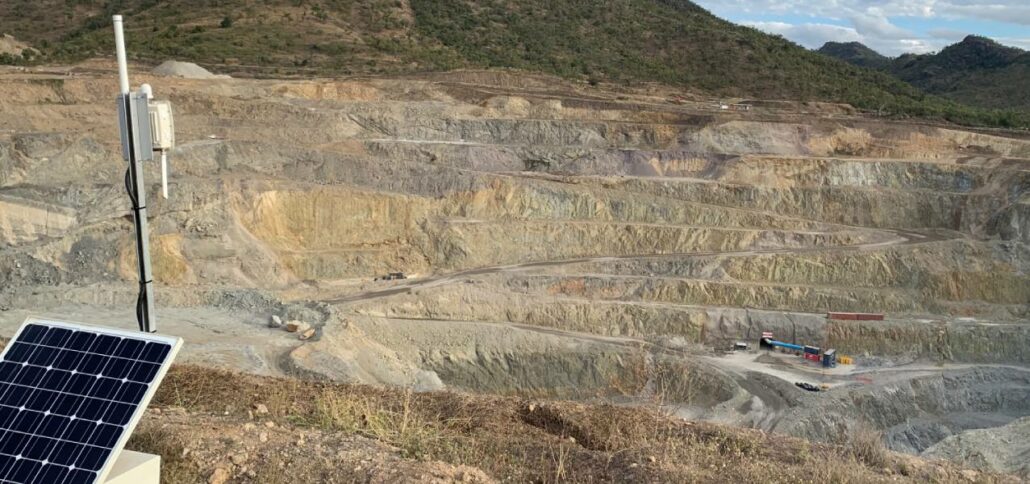
Mine deformation monitoring systems monitor structures like tailings dams, open cut walls, and fixed plant for deformation including cracks, slippage, or any other movement outside of set tolerance parameters. These automated systems are more efficient, accurate, and thorough than labour-intensive traditional systems that rely on more manual processes and are harder to scale. Automated mine monitoring technology picks up deformations in mine structures by tracking movement, temperature, vibration and more. The data is sent wirelessly to the office for review by managers, surveyors and other key stakeholders, where they can analyse changes over time or get immediate alerts if there are more significant movements that require prompt attention. These systems are becoming increasingly popular following dam collapses at
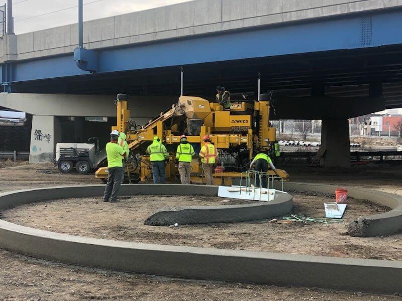
Topcon Positioning Group has announced system solutions designed to support kerb and gutter paving professionals by maintaining productivity and accuracy, even when facing difficult GPS/GNSS coverage issues. Using either the GT-1200 series robotic total station or the LN-150 construction set out tool, customers can augment their existing mmGPS concrete paving solution and remedy issues such as foliage canopies, large buildings, tunnels, overpasses, and more. “Although mmGPS has become the gold standard for efficient, accurate, kerb and gutter work, situations do arise in which that solution is simply not available,” said Brian Lingobardo, Topcon business manager, concrete paving. “In such cases, temporarily turning control of the paver over to a robotic instrument will still ensure that production is maintained.”
Machine guidance helps to improve productivity of not only the machines, but the operators on site as well. High precision machine guidance technology provides a 3D visual of each machine’s location in the mine, as well as an accurate status of the machine’s position in relation to the mine plan. Machine guidance uses positioning data to track the location, volume and material type a machine is moving. The machine operator can easily view this information via onboard displays, and use this knowledge to evaluate how they can better work to the mine design. With real-time as-built information available to operators and supervisors, the technology improves efficiency and productivity on site, helping to reduce or eliminate rehandling and rework.
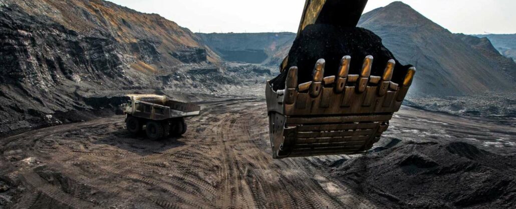
Machine guidance is a technology that precisely tracks a machine within a mine to ensure adherence to the mine plan. It gives machine operators and project managers data to stop over digging, under digging, and digging in the wrong location. These uses have ensured machine guidance system’s success in improving mine productivity since mine sites began using it over 20 years ago. Understanding the big picture A mine plan is essentially a business plan outlining how to get the most out of the resources of a mine. Combined with a mine design, a project timeline, and budgets, a mine plan lays out the project goals from mine construction to mine production that everyone from the project managers to

This June, Aptella has signed up to join The Dream Run to raise funds for The Smith Family to help children in need make the most out of their education. One in six Australian children live in poverty, which puts them at risk at falling behind with their learning, Aptella is raising money to support these kids so they can dream BIG and create a better future for themselves! Aptella has entered four teams this year, with team members choosing to walk or run 25km, 50km or 100km! If you’d like to donate to one of these teams and help change the lives of Australian children living in poverty please click on one of the links below: The

Fleet Management Systems (FMS) provide mine management with relevant production, machine utilisation and health data. But how much of this data do you actually use? In the mining industry, the main objective of a fleet management system is to optimise mine productivity and efficiency based on real-time data. An FMS aims to increase production and improve a fleet’s operational efficiency while minimising costs. Understanding this data is what drives the change to make small improvements in a mine site. FMS needs to be running from 6 to 12 months to gather enough data to understand where the strengths and flaws are. Based on historical data, then managers can flag what improvements can be made and act upon and drive the change from operators to