Powerful analysis and visualisation of your drone surveys. Virtual Surveyor is ideal for civil construction, infrastructure, mining and quarrying projects of any size.
From road surveying to topography mapping, volume calculations and cut/fill mapping, Virtual Surveyor gives you the tools to quickly and accurately track and optimise your project as it takes shape.
Want to give it a try? Start your FREE 14-day trial today
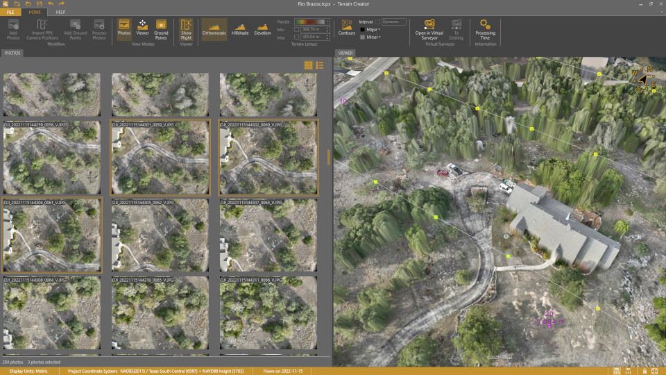
Virtual Surveyor enables you to stitch together digital elevation models and orthophotos to create interactive 3D models of the surveyed area.
Virtual Surveyor version 7.1 now released with new water tools!
Updates include:
Ability to remove noise over bodies of water with the Extract Level feature (Peak)
Calculate fill volumes with the new Water Item (Mountain and Peak)
Easily load orthophotos in CAD software with new export tab including JPEG 2000 option
Enhanced styling options for your surfaces via the Tools tab
Check out the Langham Creek stormwater pond project to see these changes in effect:
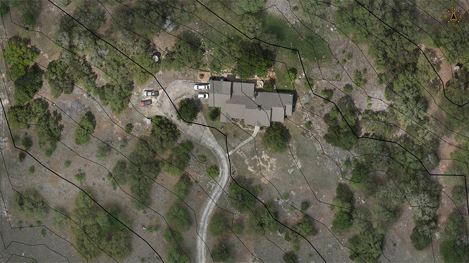
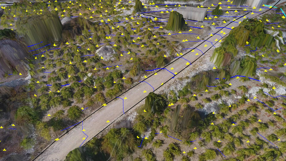
Survey points and break lines
Draw points, point grids, lines and polygons in a realistic virtual environment. Save on the field work, save time and work from the comfort of your office with the ability to analyse the environment at different angles.
Tutorial – Road Surveying Part 1
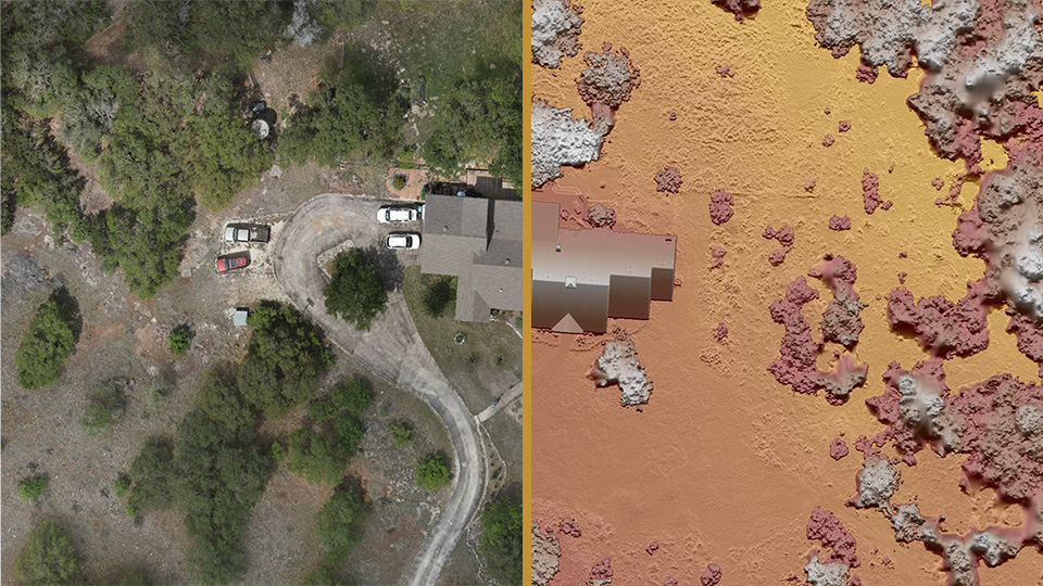
Create and import surfaces
Create a triangulation from your survey and verify instantly with with your terrain. Improve the model by adding points or break lines and triangulate again, giving you an accurate survey that truly represents the topography.
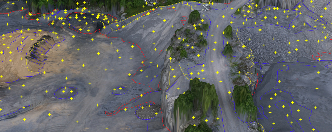
Create a TIN of a quarry
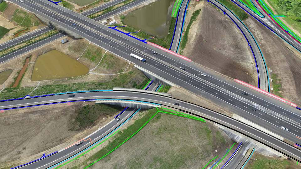
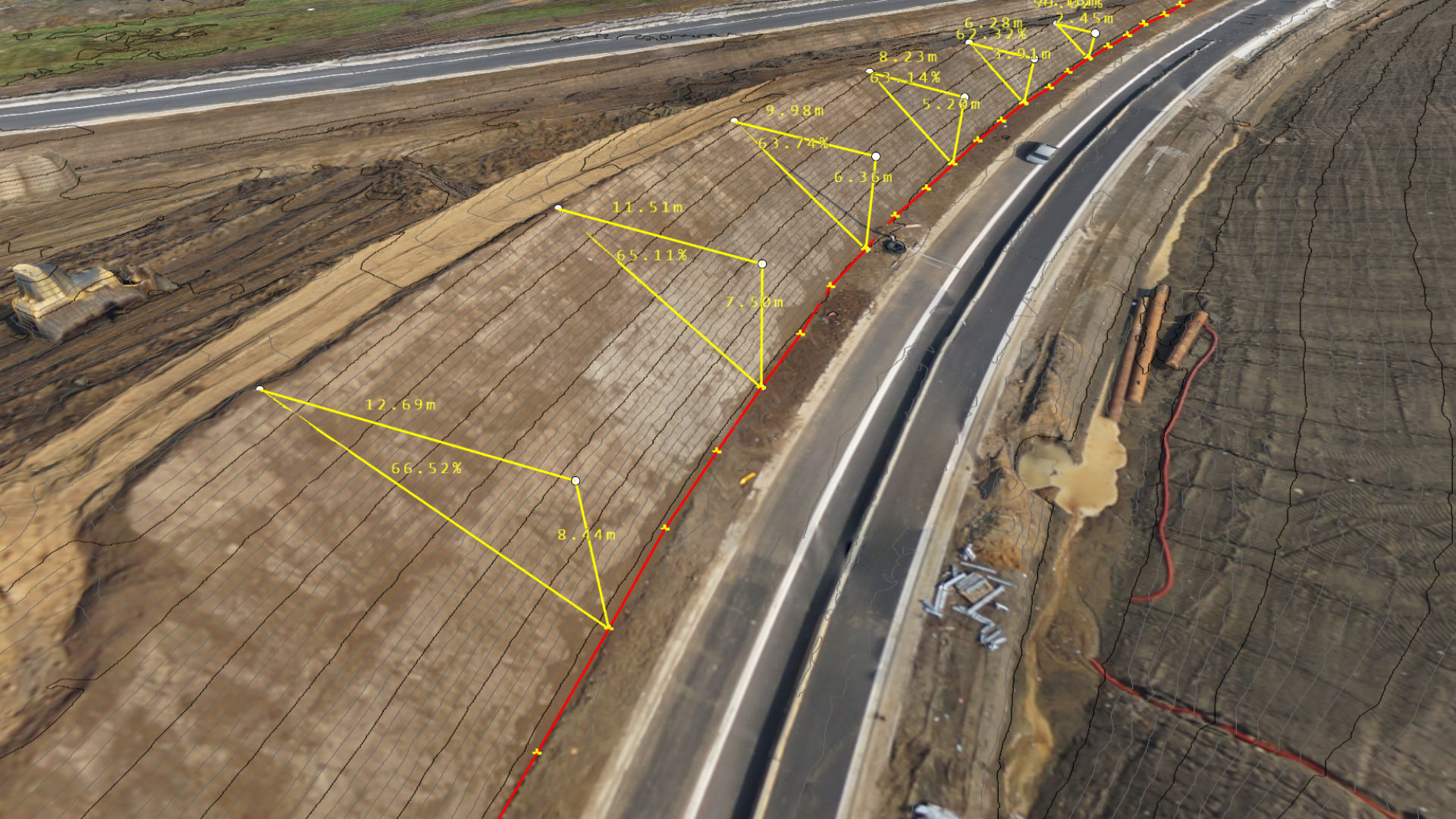
Quickly add section lines to road surveys
Simply create a centre line for the road, then add and densify section lines to create road surfaces quickly and accurately, modelled on the existing topography.
A road survey with section lines
Topographic Surveying
Surveying Curb and Gutter [with DRONES]
A Road Survey with Section Lines [6 Steps]
Tutorial – Road Surveying: Create Topography
Tutorial – Road Surveying: Capture Features
Tutorial – Road Surveying: Model a Bridge
Tutorial – Low-pass Points
Mining and Quarrying
7 Best Practices for Cut/Fill Maps
Sand Pit Dredging Operations
Tutorial – Create a TIN of a Quarry
Tutorial – Guided Breakline Drawing
Tutorial – Q-Points
Construction Earthworks
Construction Site Earthworks Monitoring [DIRT]
Stormwater Retention Pond Earthworks
Terrain States [5 Ideas]
Stockpile Inventory
3 Methods to Remove a Conveyor
Volume Calculations with the Quick Surface Tool
Reviews
There are no reviews yet.
Be the first to review “Virtual Surveyor” Cancel reply
Reviews
There are no reviews yet.