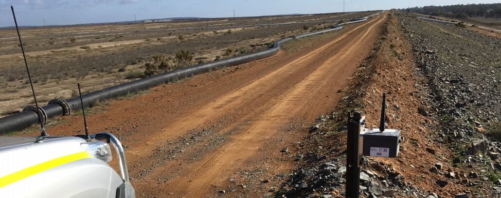
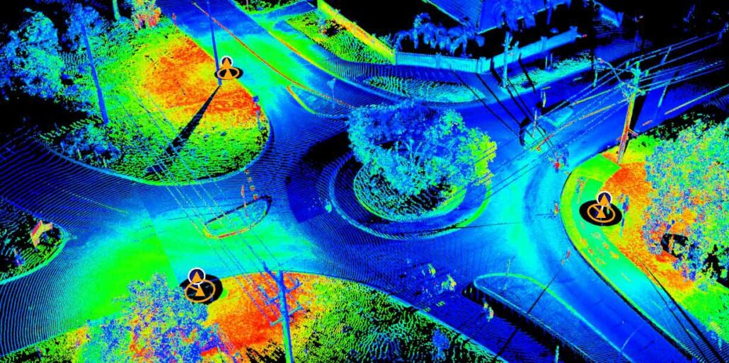
How are you monitoring your tailings storage facility? Access the on-demand webinar Join us for this webinar were we discuss the trends in dam failure, the capability of the Senceive hardware as well as an introduction to the WebMonitor platform. Aptella has been working with Senceive, the premier provider of wireless instrumentation, to assist mine sites monitor one of their highest risk assets: the tailings dam. In this webinar we will examine tailings dam failures, tailings dam construction; monitoring methodology and Senceive capability. Duration: 45 minutes Presenter: Andrew Jones, Deformation Monitoring Market Development Manager, Aptella and Heath Low, Deformation Monitoring Business Development Manager, Aptella Access Webinar

Register Your Interest today For The Building Construction Site Set Out Made Easy Online Presentation and Demonstration! Aptella would like to invite you to book your place in one of our upcoming online presentation and demonstrations on how to easily do your own site set out with the Topcon LN-150. This is the latest site set-out tool from Topcon that will enable you to set out penetrations, wet-areas, holding down bolts, wet areas and generally take control of your site quickly and accurately without having to use stringlines or tape measures. During this presentation and demonstration we will look at the key features of the Topcon LN-150, go through the Topcon LN-150 workflow, show you how you can quickly
DM Civil is a mid-sized civil construction company in Western Australia that has a reputation for being early adopters of technology. Mark McGurdy, Survey Manager at DM Civil makes sure he’s abreast of any new developments hitting the market and this made him a natural fit to test MiRTK. “Karl O’Toole from Aptella approached me and asked if we’d be interested in testing MiRTK, to evaluate it and report on how it went. We gave it a go and we’ve been testing it now for a few months and like I say: Where you need it, it’s perfect! It works every time,” said Mr McGurdy. MiRTK – Correction Service integrates seamlessly with existing GNSS on site Mr McGurdy
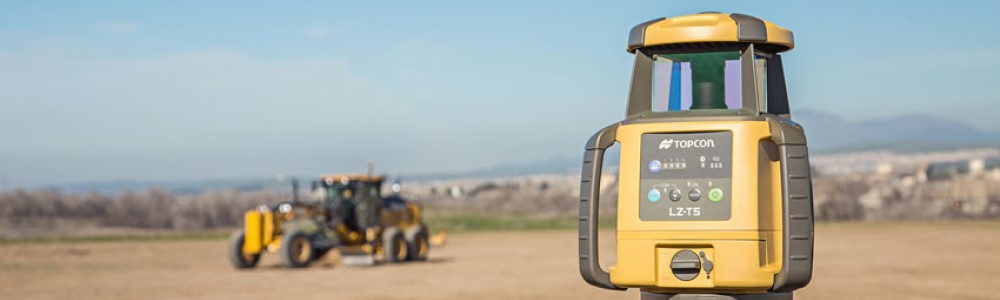
Whilst all machine control laser receivers are all capable of receiving a laser beam, which by its very nature is millimetre accurate in most cases, this does not mean the system is “mm-GPS”. Topcon mm-GPS, the only true mm-GPS, is heavily patented and was released by Topcon in 2005. It uses fan-beam laser technology only available to Topcon to pair the mm-accurate vertical positioning of the Topcon mm-GPS laser transmitter (the PZL-1 or the LZ-T5) with GNSS positioning to create truly mm-accurate 3D machine control positioning. Other systems and other brands may claim they can do “millimetre”, but that simply means they are using an off the shelf standard flat plane or sloping laser transmitter and a simple
Garry MacPhail, Business Manager – Geospatial, Aptella discusses the evolution of technology and its benefits for the surveying profession. After completing surveying college, Garry MacPhail, Business Manager – Geospatial, Aptella, discovered that his true passion was technology and how it could assist the surveying profession in automating a task or improving workflows. This passion led him into a career selling innovative equipment into the marketplace. “My biggest passion is automating a task and making a difference to the surveyor’s workflow. This has been the most important thing for me throughout my career,” said Mr MacPhail. “It’s that continuous improvement and refining Aptella’ products to give better productivity and help surveyors do their tasks better.” Evolution of technology Over
Ideal for a wide range of applications including infrastructure, mining and even forensic survey tasks, Topcon’s GTL-1000 combines the advantages of a one-person robotic total station with a terrestrial 3D laser scanner. “There are many types of survey jobs where a combination of both technologies would be an advantage,” said Paul Malatzky, Scanning Market Development Manager for Aptella. Ideal applications for this technology are widespread, including but not limited to: Building Information Modelling (BIM); feature and detail capture on roads, intersections, roundabouts, and linear infrastructure; as well as tunnelling and forensic work. “With this innovative system, users can quickly take a 3D scan of the environment to enhance the data collected with traditional optical surveys,” he added. “Road
TP-L6 series now available in red or green beam, with enhanced features including shorter length to accommodate tight pits. Topcon Positioning Systems has released a new and improved pipe laser range, designed for plumbing, drainage, and utility applications. The TP-L6 pipe laser has a more compact design than earlier models, giving contractors greater flexibility when working in tight pits. Available in red or green beam and backed by a 5-year warranty, the new model offers enhanced battery performance, working for up to 60 hours off a single charge. Android smartphone users can also control and view grade information using Topcon’s new Laser Manager app. Alternatively, the RC-500 remote control can be used to adjust settings on the laser.
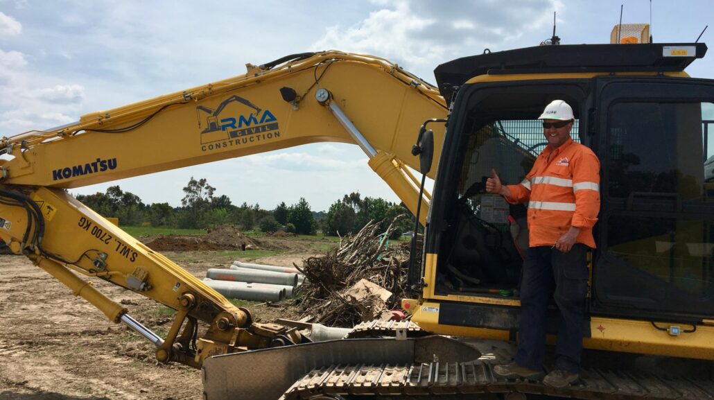
RMA Civil implemented Blue Electronics Bluetooth Close Proximity Detection and Collision Awareness Technology from Aptella to increase safety on site for the drainage team that work in close proximity with machines. Now having used the technology, the team wouldn’t be without it. Matt Ayres, Manager/Director, RMA Civil was introduced to the Blue Electronics Bluetooth Close Proximity Detection and Collision Awareness Technology at a Dig Day where the technology was installed and being demonstrated on the Komatsu PC240LC-11 excavator. “It sort of pricked in my mind that it would work well with our drainage crew that work in close proximity to the machine,” said Mr Ayres. “So that was just a no brainer for us – yeah the boys