At Aptella, we make calculating your cut and fill volumes and ratios easier and more cost-effective with our line of innovative drones and drone technology. This new extensive range of drone technology is aimed at making site surveying easier and more cost-effective. By increasing the survey accuracy and utilising the high quality, durable and innovative drone and software programs, large site areas can be surveyed in half the time. By utilising remote flight technology, this cuts the number of boots on the ground required which is generally what increases surveying costs.
What was once a 2-3 day job requiring sometimes up to 10 employees or surveyors has now turned into a half-day job needing only the aircraft pilot, a spotter and maybe the office intern for some friendly banter.
Before drone technology for GPS mapping existed, there were two very manual ways of calculating cut and fill ratios for your job site. The first of which uses a grid method which calls for your construction plans to be laid out over a flat surface and then divided up equally into to set grid squares. This then allows you to calculate and determine what cut and fill are required per each individual grid section. Following this, all grid sections can be added together for the overall volume required +/- 20%.
The second outdated but still efficient way of calculating cut and fill ratios is the cross-section method. This requires a very accurate graph to be mapped out where the existing elevation is located across both a vertical and horizontal axis. From here, the proposed elevations for the new plans are to be overlaid and then a grid is created between the two spaces. This then enables the surveyor to calculate each grid piece and its volume, then calculate the cut and fill ratios based on this work.
The benefits to the above methods of calculating cut and fill ratios are somewhat inexpensive however they are incredibly time-consuming and this, in turn, can increase the cost of workers as well as decrease their availability to work on other projects.
With new advanced technology in the drone surveying sector, this drastically reduces the time spent on-site, along with the time spent in generating a confusing and inaccurate report. All that is required, is a technician who is trained in drone flight. The good news here is that there are a plethora of registered training organisations that now offer drone flight and surveying courses in answer to the rise in this technique.
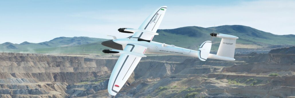
Using the Quantum Systems Trinity VTOL RPAS exclusively available from Aptella, this small but mighty drone gets to work with a simple push of a button. Navigating the skies effortlessly from a remote controller that has a simple and intuitive layout, this partnership works seamlessly to survey your required area with ease.
The integrated sensors in the cab of the aircraft are shock protected and provide an enhanced accuracy when it comes to mapping your job site. All that is required to operate this technology is a qualified drone pilot that is experienced and knowledgeable in land surveying software and how to generate reports from this data. This type of drone technology can be used to survey large areas, some equalling up to thousands of hectares.
While the drone pilot flies the aircraft over an area, the intuitive and accurate geotagging measures the exact trigger points and generates a precise image of the below surface. High-quality images and footage are saved to the high performing SD cards which are easily accessible from the outside of the aircraft.
After a successful flight, the stand-alone Agisoft Metashape software begins the process of photogrammetric processing of all digital images taken and generates 3D spatial data. This allows surveyors to gain an accurate description of the area and to begin to plan work. Taking it a step further, at Aptella, we have a range of mapping software programs that allow surveyors to accurately calculate cut and fill ratios easily with a basic click of a mouse, easily cutting down the time spent on laborious reports and manual calculations.
Drone technology being used for the purpose of calculating cut and fill ratios has a magnitude of benefits. Most of which includes both cost and time savings to the business. Other benefits of drone technology include:
With drone technology advancing with every year its practical purposes grow as well. With the costs associated with drones also coming down dramatically in the past few years, there has never been a better time to buy a drone that will make your life easier and save time and money. Aptella drone surveying technology is some of the best in the industry, purposely built to complete large scale cut and fill ratio calculations with next to no effort. With the costs of surveying increasing every day you have to find new and innovative ways to not only keep costs down but move forward with the industry.
One Response
Nice blog! Thank you for sharing this blog.