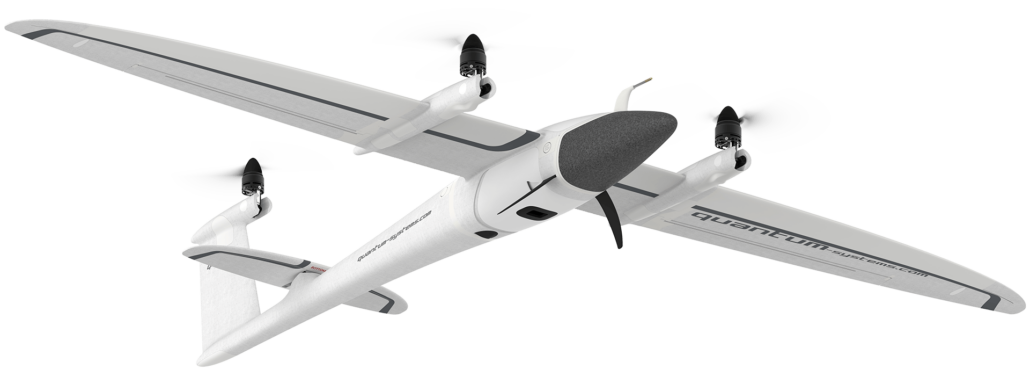
Take Off
Often referred to as RPAS (remote piloted aircraft system) – fixed-wing drones are unmanned aircraft with fixed wings that are unable to hover in a single spot, which makes launching these drones into the sky more difficult. Depending on the size of the drone, it used to be necessary to launch the drone into the air by use of a runway or catapult launcher. Recently, however, Aptella has focused on a new class of fixed-wing drones – call RPAS VTOL – that can actually be launched like a multi-rotor drone using tiny rotors that fly the aircraft vertically at take off. After take-off, they proceed to glide like a regular aircraft using normal aerodynamics – which makes them hyper-efficient in terms of power. Click here to view our VTOL products.
Flight
Fixed-wing drones have a similar design to standard aeroplanes that are lifted by wind rushing over and underneath a wing expanse. As we previously established, fixed-wing drones cannot hover in the air in one location, which makes them unsuitable for survey activities where the aircraft must turn or pivot quickly, or hover in one place. Fixed-wing drones are powered by gas engines or large batteries. The aerodynamics of a fixed-wing unmanned aircraft allows them to map larger ground areas and cover longer distances for up to 16 hours, in some cases.
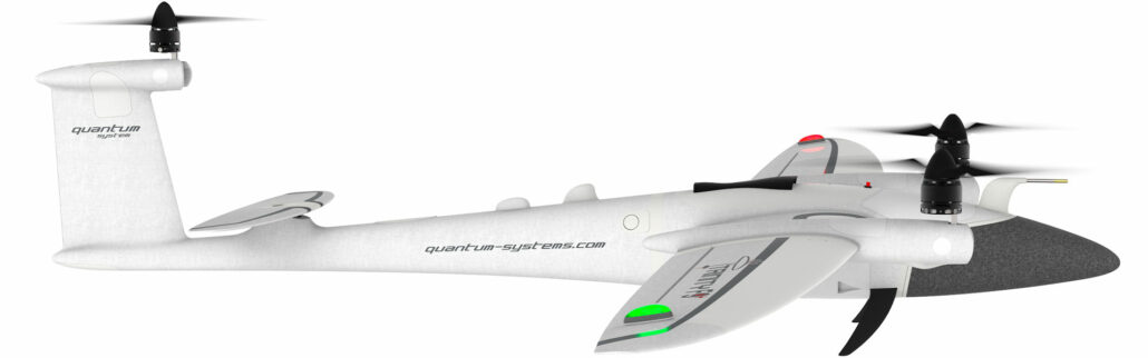
Landing
Once you completed your survey project using your fixed-wing drone, it is essential to safely land and retrieve the drone by using a runway, parachute or net – as was consistent with older technology for UAVs. Now VTOL capabilities mean the drone can be flown easily back to base by the operator using the rotors over the wing and can be landed very precisely at a specified location, similar to the way that multi-rotor drones land.
Application
Fixed-wing drones fly long-ranges and are therefore ideal for accurate, long-range survey-grade aerial mapping and photogrammetric surveying. With a minimum of a 90 minute flying time, they can cover a lot of ground – and have a range of 7.5km. They are able to map the topography and ground below to a +/-2-5cm accuracy.
Single Rotor Drones
Take Off
Single rotor drones closely resemble helicopters when it comes to their design and structure. Therefore, the launch of a single rotor drone is also similar to helicopters and requires special training. You need special approval from Australia’s Civil Aviation Safety Authority to fly a single rotor drone.
Flight
The flight of single rotor drones is also similar to helicopters. These drones are powered by a gas motor for long endurance. The aerodynamics of a single rotor drone is highly efficient with longer and slower spinning rotor blades. These single rotor drones can also pose safety risks and must be operated by someone with an aviation license.
Landing
Landing single rotor drones can be a difficult task due to their unpredictability in certain conditions. Not only can these drones hover in a single spot, but they can also be unstable and unforgiving in the event of a bad landing.
Application
Single rotor drones are used for surveyors and construction professionals who want to lift heavier payloads of up to 40kgs because the single rotor is more efficient in the lift and uses less battery or fuel life as it flies. They can also fly faster than multi-rotors. Aptella does not currently stock single rotor drones – as today’s most advanced technology in fixed-wing and multi-rotor drones provides adequate flexibility for Australian surveyors and their needs onsite.
Multi-Rotor Drones – VTOL Quadcopter UAVs