Cameron Waters, Geospatial Business Manager, Aptella
Do you want to improve your data workflow efficiencies from the field to the office in a simple to use but powerful package that can consume multiple data types for adjustment all while delivering complete data integrity?
In a recent article (Unlock your survey software’s potential), I discussed the inclusion of MAGNET TOOLS in all the new MAGNET software packages. It’s this unsung hero that will change the way you look at data management from the field.
At its core, MAGNET TOOLS provides customisable processing and adjustment options for data collected using optical total station systems and GNSS hardware.
GET THE DATA
Getting the data from the field to the office is optimised with the MAGNET workflow and the included cloud enterprise module but the power of TOOLS is the huge import library spanning multiple brands and data types, including 15 different raw total station types and 12 different raw GNSS observation types. And if you can’t find it? Customise it with the custom format options!
Automated data clash detection
Any data source that isn’t in the defined grid system or has duplicate data will be automatically identified on import, saving you time and immediately improving your data integrity.
SEE IT, SORT IT. SORTED
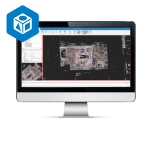
Powerful visualisation tools allow for map and tabular views to easily verify data and make QA decisions. Access to web services, like Bing, provides a simple background to get some local situational awareness from the office. Filters allow easy switch between your data types to prepare the data for processing and adjustment.
PROCESS WITH CONFIDENCE
GNSS processing has never been easier with years of input since the world first release of the integrated GNSS system, the Hiper-Lite. The various optical adjustments and lease squares calculations provide dimensional control quality to support the hard work in the field.
A flexible software solution for daily data processing, customized reporting, and collaborative visualisation.
EXPORT, REPORT, REPEAT
Almost any export type and format is possible with the massive library of options. Direct connections to MAGNET Office products and Civil 3D can be achieved with a single click.
Reporting on any closure, control, observation, adjustment and a list of other parameters are easily created with the completely customisable reports.
The data management role of the surveyor in the company or on the project is the guardian of the data integrity and accuracy. MAGNET TOOLS can do for your data, what the Hiper-Lite did for surveying! Get started today with the MAGNET workplace.