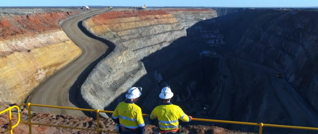
Over recent years, we have witnessed drone technology advancements push aside the traditional methods of mine monitoring and surveying. Drones have become increasingly popular in support of mining applications with exploration, surveying and mapping. Australia and Africa have led the way in adoption of unmanned aerial vehicles (UAVs) across their mining industries to maintain safety, increase oversight and enhance security. Drone Mining Survey UAVs (unmanned aerial vehicles) have been increasing in popularity in the mining industry for the last 10 years. As the technology has improved in leaps and bounds, so too has the number of drones deployed on mine sites for a variety of applications. Drones using cameras, LIDAR technology, or plugged into photogrammetry software, can create
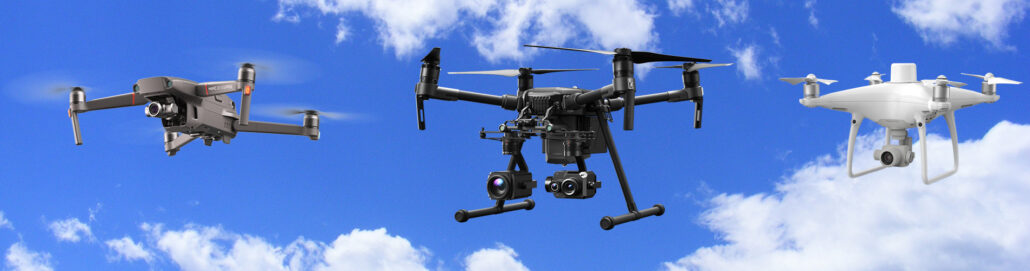
We classify our drones as unmanned aerial vehicles (UAV), which are aircraft without a human pilot onboard. This is the overall category of drone survey and geospatial equipment, which includes a range of different aircraft used for different survey purposes Within the UAV category of survey equipment is the latest flying and launching technology – referred to as V.T.O.L – which means an unmanned aircraft that has a Vertical Take Off and Landing. We talk more about VTOL and VTOL payload over here on this blog: Click here to read about VTOL Payload. This article dives deep into the different types of drones that are on the market today or about to be released – Aptella offer a

In the world of survey drones, major technological advancements have occurred over recent years. We have seen surges in payloads, aerial surveying capability, flight duration, flight distances and user operation technology Drones are essentially an aircraft that doesn’t have a human pilot onboard, instead, they are controlled by an autonomous onboard computer or an operator who is stationed on land. It is also common for most surveying UAV (unmanned aerial vehicle) drones to be equipped with VTOL (vertical take-off and landing) capabilities – as a matter of course in 2020. What is the Difference between VTOL and UAV in Aerial Surveying? We distinguish some drones used for aerial surveying as VTOL and some as standard UAV. It is
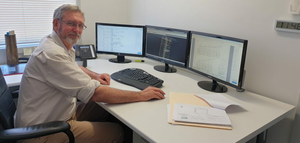
Relied upon by cadastral and topographic surveyors, engineers, architects and drafters, CAD software is used to create and manage plans or projects in a digital format. The software available on the market today has come a long way from the early years of computer programs. In this article we’ll step through the evolution of civilcad, a popular and Australian-developed solution that has a long history and is today known as MAGNET Office, which now forms part of the MAGNET Systems Workflow. Cliff Stewart is a land and mine surveyor with more than 30 years’ experience in land development projects. During his career, he’s also worked on 13 mine sites and is authorised for all aspects of underground and

DM Civil is a mid-sized civil construction company in Western Australia, Australia that has a reputation for being early adopters of technology. Mark McGurdy, Survey Manager at DM Civil makes sure he’s abreast of any new developments hitting the market and this made him a natural fit to test MiRTK. “Karl O’Toole from Aptella approached me and asked if we’d be interested in testing MiRTK, to evaluate it and report on how it went. We gave it a go and we’ve been testing it now for a few months and like I say: Where you need it, it’s perfect! It works every time,” said Mr McGurdy. MiRTK integrates seamlessly with existing GNSS on site Mr McGurdy has a
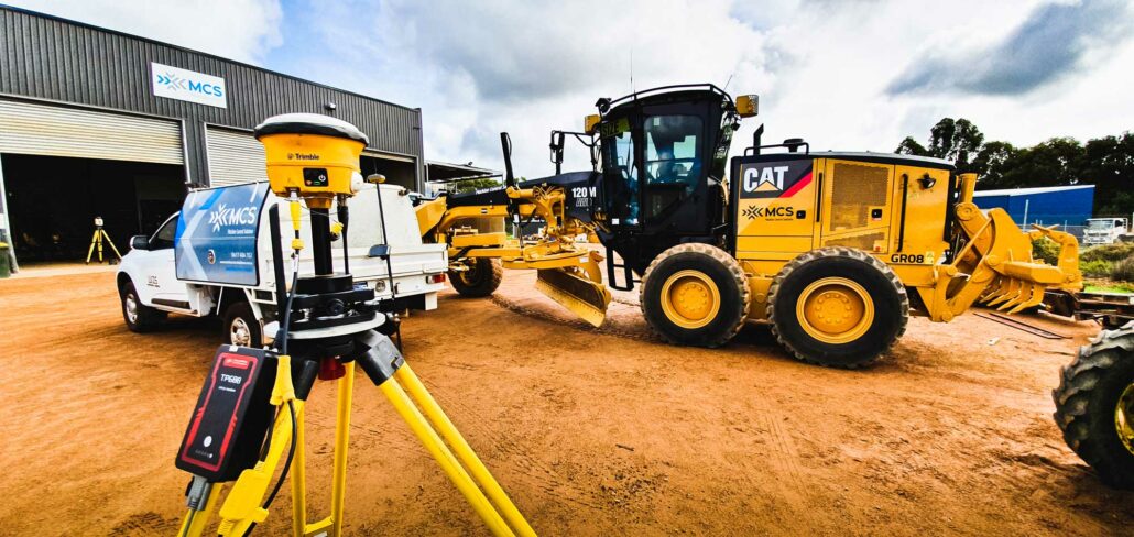
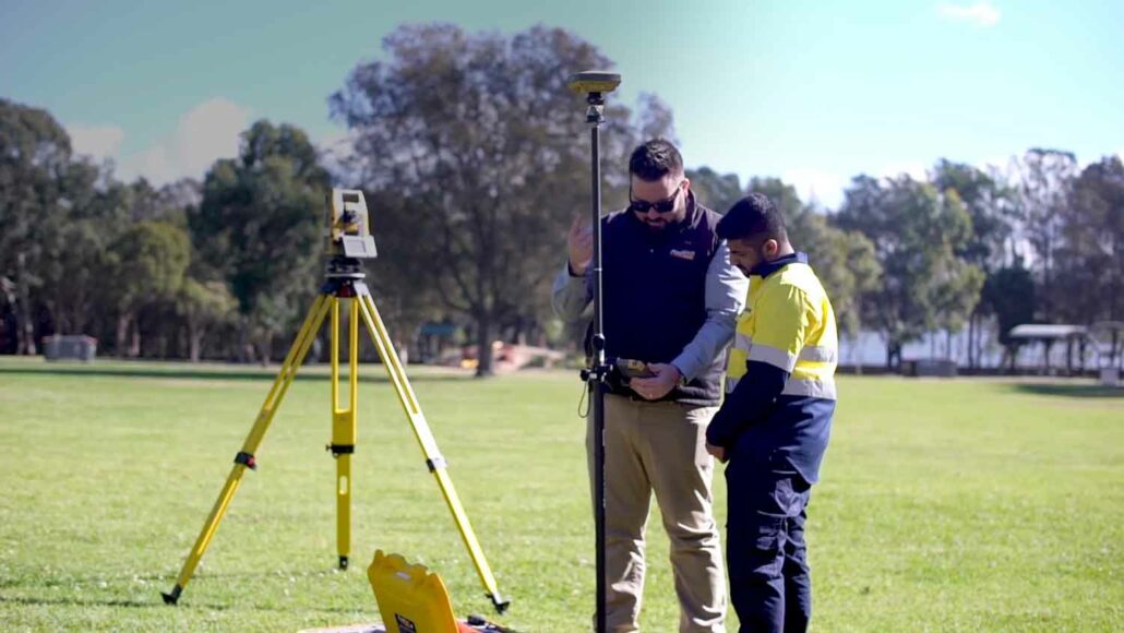
MiRTK offers an alternative to UHF radio correction services. It is used for accurate GNSS positioning in the construction, mining and geospatial industries. Works with all GNSS brands Intelligent positioning solutions provider Aptella announces the release of MiRTK. This new correction service for GNSS equipment utilises the internet instead of UHF radio frequencies. MiRTK is compatible with all brands and models of GNSS from manufacturers including Topcon, Trimble, Leica Geosystems, Sokkia, Hemisphere and more. “Until now, users that rely on high precision GNSS for applications such as surveying and machine control had no option but to use UHF radios or a network RTK solution,” said Cameron Waters, Geospatial Business Manager at Aptella. “Anyone that’s had to rely on
Garry MacPhail, Business Manager – Geospatial, Aptella discusses the evolution of technology and its benefits for the surveying profession. After completing surveying college, Garry MacPhail, Business Manager – Geospatial, Aptella, discovered that his true passion was technology and how it could assist the surveying profession in automating a task or improving workflows. This passion led him into a career selling innovative equipment into the marketplace. “My biggest passion is automating a task and making a difference to the surveyor’s workflow. This has been the most important thing for me throughout my career,” said Mr MacPhail. “It’s that continuous improvement and refining Aptella’ products to give better productivity and help surveyors do their tasks better.” Evolution of technology Over
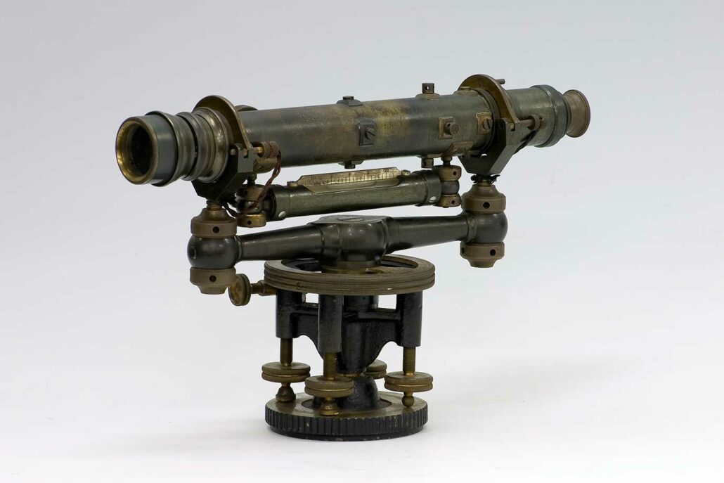
Measuring and survey instrument manufacturer (Sokkia) celebrates its 100th anniversary. The company was founded in Japan in 1920. Sokkia’s main distributor in Oceania, Aptella, reflects on the brand’s technology journey. Founded in Japan in 1920 under the name ‘Sokkisha,’ Sokkia marks its 100th year of manufacturing survey and measurement instruments for the surveying, construction and geospatial sectors. Technological innovation has come a long way since the company’s first instrument, a 12-inch Wye level that was introduced in 1920. In subsequent years, Sokkia developed a reputation for high precision and quality manufacturing of its survey instruments. Innovating in the 80s The 1980s was a period of rapid technological development for the company, including the release of the Sokkisha