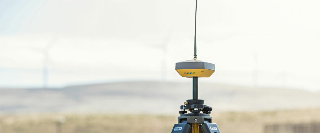
What is RTK?
RTK integrates the GNSS positioning data from a fixed base station into any compatible GNSS device, giving it centimetre accuracy. GNSS devices are used in a slew of applications, including everything from agriculture to robotics. Without RTK, the positioning accuracy of devices is around five metres, because they are susceptible to measurement errors including:
RTK is one of a few methods developed to filter out these errors and re-interpret the corrected data to provide the most accurate positioning for GNSS devices. It takes in and interprets RTCM (Radio Technical Commission for Maritime) corrections in real time to correct satellite data and calculate locations of objects based on the corrected data. While RTCM used to be just a protocol for position communication between vessels, we now also use it as a standard to talk about measurements, errors, and correction data across all GNSS devices. RTK cannot be used without a standard correction message like RTCM to interpret the satellite data.
An RTK-compatible GNSS device can process the RTK correction data, provide its position with centimetre-level accuracy and send out this data in real-time. As the fastest and most accurate GNSS data correction method, RTK base stations are the preferred equipment for civil engineers to use on construction projects.
Bridges and dams
GNSS is useful in both the construction and monitoring of bridges and dams. Civil engineers on bridge and dam construction projects build GNSS control networks to monitor and provide RTK corrections for different project stages. In the initial survey stage, GNSS survey rovers use RTK to precisely measure existing site conditions and update the project design. During the construction phase, RTK-compatible units in heavy machinery accurately stake out the design.
This information is used in elevation measurement and cross-river inspection, and to determine the point curves of a river system – which helps engineers decide where to build bridges and dams, with what supports, and with what materials. During the construction process and during upgrades, this control network of RTK base stations can be used again to record any changes to the waterway that would affect the bridge or dam, and how to manage it.
UAVs (Unmanned Aerial Vehicles) or RPAS (Remotely-Piloted Aerial Vehicles) integrated with RTK technology can also be used for structural inspections and monitoring. The RPAS can safely carry out these tasks even in inaccessible or dangerous areas.
High rise buildings
Civil engineers on high rise building construction projects use GNSS firstly to analyse surrounding buildings and construction terrain in the early construction stage, and then during construction in the same way as during bridge and dam construction with drone UAVs. They locate building piles and corners, monitor groundwater level changes, and collect settlement deformation data for quality control. Precise RTK measurements provide the information engineers require to complete quality control checks accurately, and minimise any minor building hazards before they become major ones.
Highway projects
Stake outs
When staking out a highway construction project, engineers use RTK surveying to create topography maps and as-built surveys to inform the laying out of pipes and utilities, and the road alignment and construction. For major road construction projects, using RTK as opposed to other survey or stake out methods is important as civil engineers need exact measurements to determine the road’s target grade, slope, and drainage features, quickly. Traditional methods including single-point positioning and differential GPS were too slow and too inaccurate to be useful for road construction projects at all.
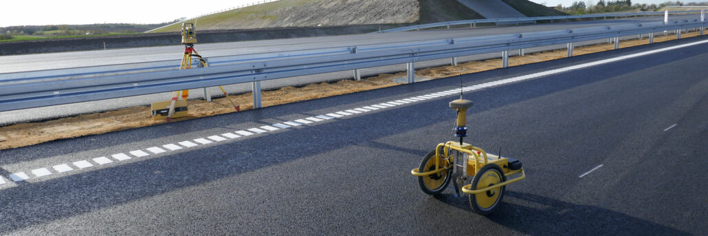
Construction
During highway construction, RTK can be integrated into earthmoving machinery for machine control purposes. Accurate machine control is essential on highway construction projects, as the exact grade of the road affects road drainage, concrete foundations, and the durability of the asphalt or bitumen atop it. Using RTK for machine control on all heavy machinery on a highway construction site ensures operators can track heavy machinery down to the centimetre for safety and to guide operators on the required grade, slope, and depth of the machine’s dig.
Aptella supplies RTK equipment for engineers
We supply MiRTK systems to civil engineers on bridge projects, dam projects, high rise projects, highway projects, and more. MiRTK is suitable for businesses of all sizes, and accessible for engineers who do not have the resources to support a traditional RTK system. MiRTK simplifies the process of getting access to RTK data by eliminating the complex licencing requirements of UHF radio receivers, where RTK data is traditionally sent. Learn more about MiRTK here or contact our friendly team for an obligation-free quote.
We source, deploy and support intelligent positioning solutions to enhance our customers’ productivity.
Aptella Pty Ltd
ABN 56 130 367 065
2024 Aptella Pty Ltd | ABN 56 130 367 065 | Terms and Conditions | Privacy Policy