Robots Using GNSS Satellite Data To Navigate Outdoor Spaces Require An RTK Correction System To Filter Out Errors In The GNSS Data, Including Clock Errors, Orbit Errors, Satellite Biases, Atmospheric Errors, And Multipath.
RTK for mobile robots
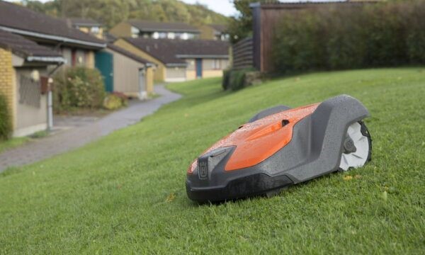
Field robotics is a sector of research focussed on building mobile robots – robots suited for performing in the field, rather than in closed environments such as warehouses or manufacturing plants. One of the basic requirements of a mobile robot is being able to move from place to place, which requires positioning.
Many methods of letting a robot know where they are have been tried and tested, but for outside applications, researchers turn time and again to GNSS satellite data. GNSS provides a positioning solution in an absolute reference frame – meaning it is compatible with any other GNSS device and the data can be used cooperatively in fleets of other devices, and with maps of the environment.
Without RTK, GNSS satellite data is accurate to around five metres. While this sounds ok for humans navigating, robots need to know exactly where they are. They do not have the same level of perception that humans do to be able to change their trajectory to avoid obstacles on their own. So, mobile robots cannot afford to work with GNSS data that hasn’t been corrected. They need an ultra-accurate correction system to filter through common satellite errors.
That’s where RTK comes in. Accurate to 1cm of the real life position of objects, RTK can correct GNSS satellite data for mobile robots operating in the field.
Why RTK and not other correction systems?
Other GNSS satellite data correction systems like SBAS, DGPS, and PPP are less accurate than RTK and have slower initialisation times (time it takes for the receiver to reach an accurate solution). This makes them impractical to field robotics applications, as mobile robots often need to navigate complex terrains with obstacles: thinking an obstacle is a metre in front of you when it is actually a centimetre in front of you is a recipe for a crash.
Their initialisation time also makes them impractical for the field, as real world terrains are constantly changing, with obstacles constantly shifting. A mobile robot needs to know what is around it in real time to navigate in real time, rather than waiting for 20 minutes to accurately know where it is.
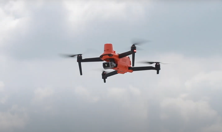
Tracking a quadrocopter: from the lab to day-to-day
RTK has aided a number of field robotics studies in innovating new technologies for automated vehicles. One such study is in tracking a quadrocopter, an experimental vehicle that could be used for surveillance, search and rescue missions, and mobile sensor networks in the future. Today, UAVs (Unmanned Aerial Vehicles) and RPAS (Remotely-Piloted Aerial Vehicles) are used for surveying, aerial inspections, agriculture, and other industrial applications.
The research team used RTK to develop a three-dimensional tracking scheme for an unmanned quadrocopter so it could start, hover, navigate, and land without the direction of a human pilot. They noted “The precision of absolute position data for the aerial vehicle can be improved significantly [with RTK] compared to a standard GPS solution.”
Though RPAS vehicles like this are used day-to-day in the industrial sector, the research team expects to create a fully autonomous quadrocopter for surveillance and search and rescue integrated with RTK in the future.
The future of RTK in robotics
The price of RTK-capable GNSS receivers is rapidly changing. System integrators can implement RTKS capability for thousands or even hundreds of dollars. This makes RTK an attractive option to use in fleets of robots.
RTK is predicted to be integrated into the positioning system of field robots to help them navigate for a number of applications, including:
MiRTK eliminates the limitations
One of the only limitations of RTK according to field robotics researchers is that it’s not available everywhere. Traditional RTK methods include using UHF radio receivers to translate the data, but UHF radio receivers must be placed close to the RTK station itself, which, when integrated with a mobile robot, is constantly moving. Complicated UHF radio licencing requirements also make field robots using traditional RTK inaccessible to certain locations in Australia.
Aptella’ MiRTK innovation is a smart device that connects RTK corrected data to the internet, so it can be accessed from anywhere with Telstra coverage, with no interference, and no complicated licencing requirements.
MiRTK reduces the barrier for entry for robotics businesses that would benefit from RTK integration by providing a cost effective and manageable RTK solution.
Find out more about MiRTK here, or contact us for more information or an obligation-free quote.
We source, deploy and support intelligent positioning solutions to enhance our customers’ productivity.
Aptella Pty Ltd
ABN 56 130 367 065
2024 Aptella Pty Ltd | ABN 56 130 367 065 | Terms and Conditions | Privacy Policy