
Wow… the first 6 months of 2023 has been rather tumultuous in the construction industry, especially the residential sector with inflation, supply chain issues, rapid interest rate rises and housing affordability coming home to roost and making for a difficult and tricky period for the industry to navigate. . However, in spite of all this, the fundamentals that have underpinned the industry for the last 20 years are all still in place and whilst the short and mid-term prospects aren’t so bright, the longer term is still looking quite promising. First, let’s unpack the bad news: the inflationary pressures brought about by global supply issues in the last two years combined with slow land release, lack of skilled

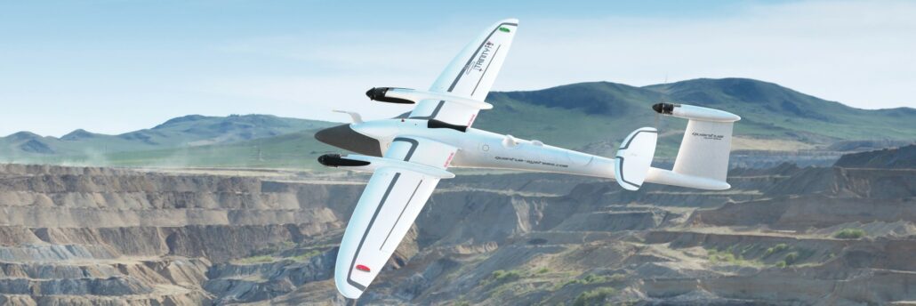
Next Generation drone from Quantum Systems expands operational capabilities, reduces risk, and provides industry-leading aerial intelligence. . Aptella is pleased to announce the availability of Quantum Systems’ new Trinity Pro remotely piloted aircraft system (RPAS) for the Australian and New Zealand market. The new model, with its broad range of sensors, further improves the ROI from its highly successful predecessor the Trinity F90+, and firmly places itself as the premier fixed-wing VTOL drone. “Having seen the new model in action during an exclusive distributor pre-release event in Germany last week, the team at Aptella is excited to introduce this high performance VTOL solution to our local market,” said Gavin Docherty, RPAS Product Manager at Aptella, Quantum Systems’ Australian
From calculating carbon credits to LiDAR mapping, the versatility of aerial mapping applications is expanding at pace. Remotely piloted aircraft systems (RPAS) are fast becoming a mainstay of surveying, engineering and geospatial applications. The technology, computer processing speeds and data integrity have come a long way since their first introduction as aerial mapping instruments in 2011. And it’s fair to say their in-flight stability, battery life and overall reliability have also improved tenfold or more. Intelligent positioning solutions provider Aptella was the first to introduce a survey-grade RPAS in 2011. “We are continuously on the look-out for innovative solutions from around the world that will improve productivity for our customers,” said Gavin Docherty, RPAS manager for the company.
The collaboration between Aptella and u-blox will facilitate the rollout of accurate positioning for a diverse range of applications, from autonomous shuttles and public transport to service robots and other Internet of Things (IoT) uses. u-blox (SIX:UBXN), a global provider of leading positioning and wireless communication technology and services, and Aptella, an Australasian provider of intelligent positioning solutions, have announced today the expanded coverage of the PointPerfect global navigation satellite system (GNSS) augmentation service to Victoria and New South Wales, including Melbourne and Sydney, as an initial step in rolling out the service to the Australian and New Zealand markets. Access to industry-standard high accuracy positioning for fleet and Internet of Things applications Available via Thingstream, u-blox’s enterprise-grade IoT
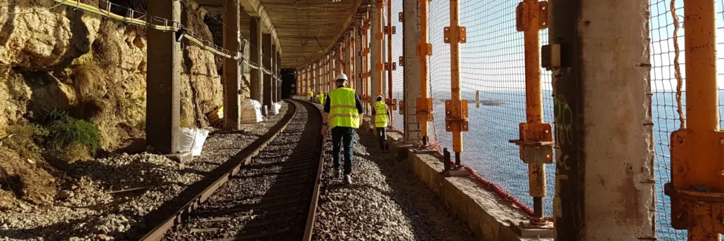
Asset Survey Solutions, a multi-discipline survey company, implemented the Senceive FlatMesh wireless sensor network from Aptella into its current project. Rail corridors are notoriously troublesome to conduct monitoring using traditional survey methods, so when Darren Dean, Survey Manager and Director of Asset Survey Solutions was starting work on a rail project as part of the LXRP removal projects in Victoria, Mr Dean knew he wanted to get the Senceive FlatMesh Network which was supplied and supported by Aptella, implemented to increase safety for his team whilst streamlining productivity and being cost effective for his clients. Prior to implementing the Senceive FlatMesh wireless sensor network , Asset Survey Solutions would have had to have multiple surveyors, in person, positioned taking
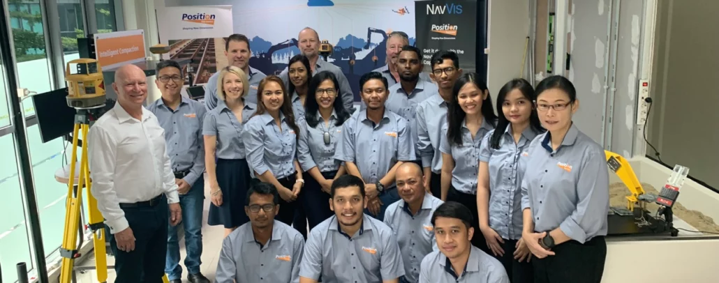
New larger premises for a growing team, supporting Indonesia’s construction and mining sector with latest positioning and automation technology. Aptella announces the opening of a new office, complete with training and experience centre, in Tangerang Selatan City, in the Banten Province of Greater Jakarta, Indonesia. With a growing need for accurate positioning and construction technology to improve productivity and safety for Indonesia’s construction and mining sectors, Aptella supports customers to successfully deploy the latest solutions, with training, technical support, and advice. Aptella has more than 30 years’ industry experience with laser levels, grade control for heavy earthmoving equipment, positioning systems and the latest mapping tools. Founded in Australian in 2008, the business now employs more than 350 people
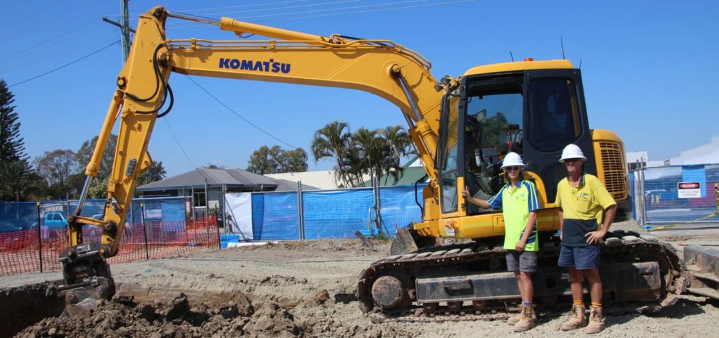
iDig is a simple 2D excavator system that gives the operator a live position of the bucket to guide them to grade quickly and accurately. It works with all makes, models and sizes of machine from little one tonne diggers up to mine excavators. Wayne Nicholson, owner and operator of Combined Excavations, explains they have the iDig system fitted to their two 1.5 tonne and 13-tonne excavators. “We utilise the 2D system to save us time on the ground as well as labour costs,” Mr Nicholson said. iDig helps operators get to grade in a range of applications, including slopes and levels, whilst providing real time information on the position of the cutting edge. It removes the need