Convert CAD or GIS features to a Hydromagic shoreline
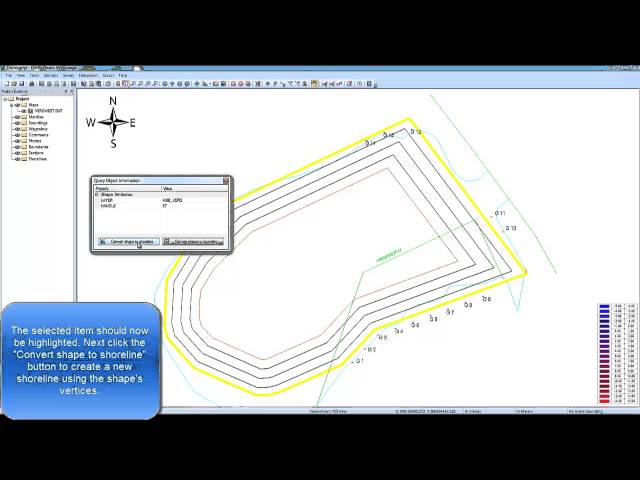
This video tutorial shows how to create a shoreline from a CAD or GIS feature (polygon or polyline) in a few steps. For more information, please refer to the manual: http://www.eye4software.com/hydromagic/manual/query.php