Aptella discusses Sokkia Gyro X II at Intergeo 2019

Cameron Waters, Geospatial Business Manager, Aptella discusses the Sokkia Gyro X II automated Gyro system at Intergeo 2019.
Cameron Waters, Geospatial Business Manager, Aptella discusses the Sokkia Gyro X II automated Gyro system at Intergeo 2019.
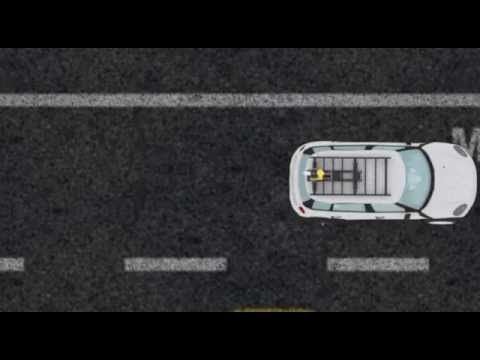
COMPACT, HIGH DENSITY 3D MOBILE MAPPING SYSTEM The IP-S3 mobile mapping system offers high density, high precision, point clouds combined with high resolution panoramas from a system that is smaller, lighter and easier to handle. IP-S3’s positioning system is an integration of an Inertial Measurement Unit (IMU), GNSS receiver (GPS and GLONASS) and a vehicle odometer. It provides precise positioning and attitude in a dynamic environment. The rotating LiDAR sensor captures the environment with a rate of 700,000 pulses per second. During each rotation, the 32 internal lasers cover the full 360 degrees around the system, each from a slightly different viewing angle. This minimizes gaps in the point cloud which arise from obstacles or dead-angles and removes