
A guide to optimising the 2D or 3D grading system on your project Systematic grading technology represents one of the highest points of innovation and development within the earthmoving and construction industries, yielding increased productivity and an enticing return-on-investment. One of the most notable pain points prospective buyers experience, however, is finding a 2D or 3D grading system that best optimises their machines to suit project specifications. The release of multiple grading systems has sparked confusion surrounding which alternative is the ‘best’ and caused debate around both 2D and 3D grading technology. It can be hard to determine when an additional dimension is required for survey accuracy, understanding the basics is essential. Each machine guidance system aims to
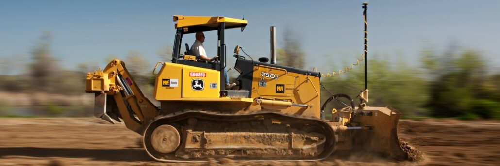
A brief introduction to GPS in the earthmoving industry The Global Positioning System (GPS) was established in 1973 by the United States to overcome the limitations of previous navigation systems and has since grown to hold extensive utility across a range of alternate applications, including the earthmoving industry. Today, the earthmoving industry has been one of the most innovative adopters of GPS technology; co-developing guidance systems which utilise positioning data to digitally map grade and design features. GPS first transcended into the earthmoving sector amidst the late 1990s following the formation of corporate partnerships between renowned heavy equipment manufacturers and GPS guidance system manufacturers. These systems helped to systematically innovate the earthmoving industry through advanced machine guidance and
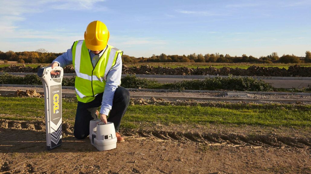
A guide to cable and pipe locator technology Cable and pipe locator technology presents a solution to critical considerations surrounding the construction industry, ensuring underground utilities are successfully mapped and avoided throughout earthmoving projects. A multitude of vital utilities are currently located underground including gas lines, telephone lines, and water pipers – all of which must be identified before excavation or construction can commence. The process of cable and pipe location itself, revolves the accurate detection and mapping of underground utilities, involving highly technical pipe and cable locating tools. Though services and equipment both come at an additional cost, risking damage to existing underground infrastructure is much more costly than simply managing safe excavation practices. Understanding how utility
Toby Mead and his team at Meadson Constructions are currently working on the Stella Apartments in Rose Bay, NSW. This project will produce 12 high-end finished, luxurious apartments but in the planning stage of the project, Mr Mead reached out to Aptella looking for a site set out solution. “I engaged Aptella after reading up about the LN-100 3D site set out tool, basically because the project is built on two angles that are not square to each other and it I looked into it and the Topcon LN-100 3D set out tool would be the easiest way to actually do the project,” said Toby Mead, Owner, Meadson Constructions. Why did Meadson Constructions choose the LN-100 3D set
A brief introduction to loader scales New technology that aims to maximise operational results has always been highly adopted across industries dealing with bulk material processing, holding a known ability to yield enticing results. It’s rare to discover such a simple yet vital piece of technology that can work to underpin day-to-day operations so, when such a product surfaces, it’s guaranteed to create a lasting impact. Loader weighing scales have become a favoured investment across industries where ascertaining product weight is an essential consideration in risk prevention, process optimisation, and commercial transacting. This small device holds an exceptional reputation amongst consumers with an ability to significantly streamline business operations, presenting itself as an indispensable asset across a broad
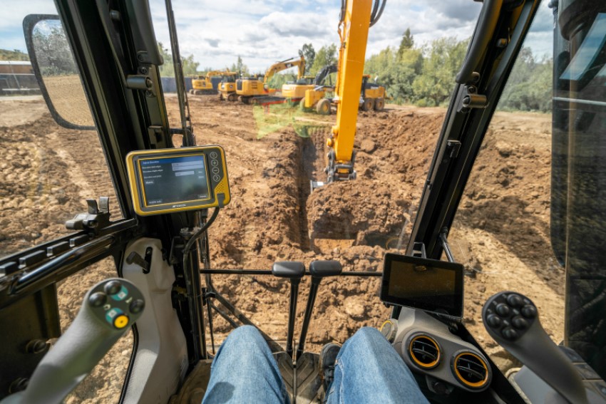
At Aptella, we’re massive fans of machine control technology because we’ve seen the changes in operator confidence and productivity first hand. We’ve witnessed construction projects finished before their scheduled end date thanks to machine control and know its importance on construction projects will only grow in the coming decade. Topcon, our number one construction positioning systems partner has always been an industry leader for machine control systems. From the start, Topcon has been producing high-quality machine guidance and control systems. If you’ve worked on an excavator in the past 30 years, there’s a good chance that you’ve used Topcon technology. This is because almost all operators and fleet managers have embraced excavator guidance and control in some form
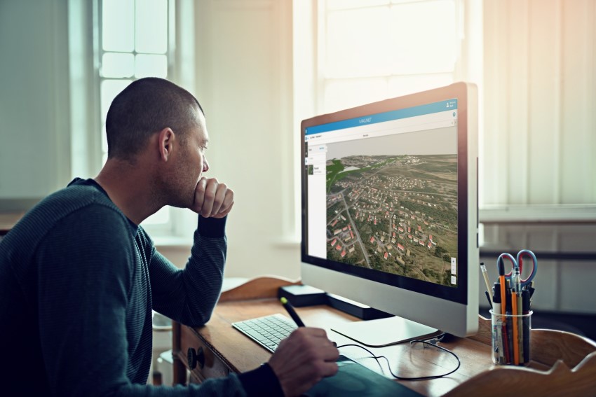
MAGNET 6 is here and is providing users with efficient data flow and greater productivity. With the release of MAGNET 6.1, you will experience greater productivity than ever before with this software solution enabling the management of huge amounts of information around resources, scheduling and risk management. MAGNET helps workers communicate with the field and collects data from different sources, combines many sources of data into one 3D model so you can manipulate the designs and visualise them, share information, reliable information, accurate take offs etc. With MAGNET Field, you can perform 3D layout with a BIM interface that enables multiple floor views including filtering by level with the popular IFC file format. Additionally, MAGNET now supports Autodesk
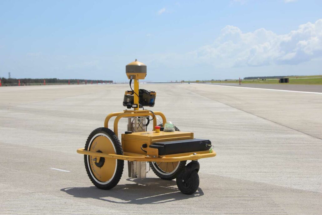
During the construction of a road there are several line marking tasks that are traditionally done by a surveyor. The change to a digital construction model means a repeatable task, like line marking, is perfectly suited to automation – allowing the surveyor to concentrate on more project critical tasks. The Tiny Surveyor from Aptella is a robotic pre-marker tool that will save you time, increase safety and enable you to mark out road lines automatically. Do you want to see the Tiny Surveyor in action? Download the Tiny Surveyor On Demand Webinar from Aptella. The Tiny Surveyor line marking robot: Is 10 times faster than marking on foot; Works with GNSS and total stations; Increases safety by reducing